

MacArthur Basalt Quarry
0 Hwy 19, Kimberly, OR | Lat/Lng: 44.6080, -119.6768
$511,000
19 ac.
07/21/2026
ACTIVE
Description
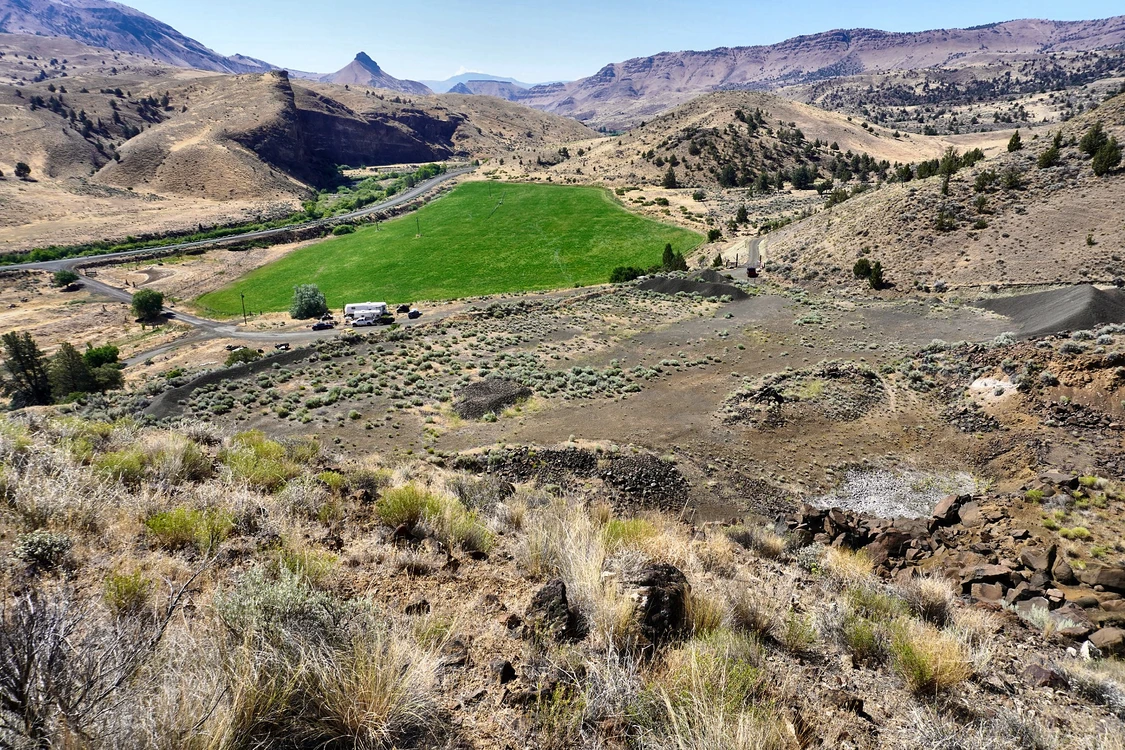
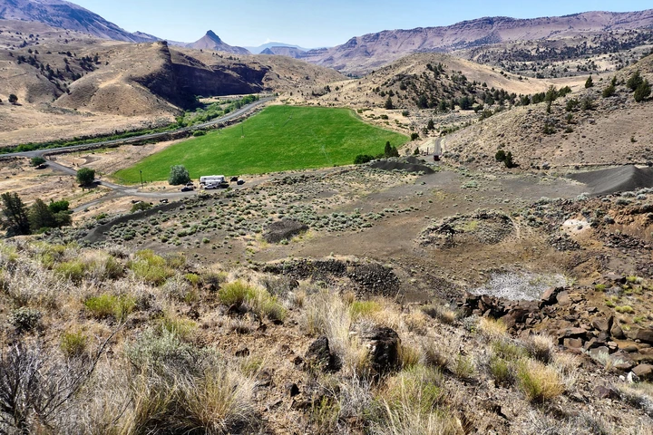
MacArthur Quarry offers a rare opportunity to acquire a documented basalt resource in Grant County, Oregon. The approximately 19-acre DOGAMI permit area contains Picture Gorge Basalt, with a 2019 professional evaluation estimating approximately 612,200 cubic yards of in-situ material, plus existing crushed aggregate and basalt rock stockpiles. Laboratory testing found the sampled material met ODOT abrasion specifications.
Land
MacArthur Quarry presents a rare opportunity to acquire a developed basalt resource in Grant County, Oregon. Located west of Oregon Highway 19 near Milepost 120, the quarry is approximately two miles north of the Thomas Condon Visitor Center.
A professional mineral resource evaluation completed in 2019 identified Picture Gorge Basalt as the quarry's primary resource. The evaluation estimated approximately 612,200 cubic yards of in-situ basalt within the roughly 19-acre permit area, equivalent to approximately 1.47 million tons before extraction and bulking adjustments. The report also documented approximately 1,935 cubic yards of crushed aggregate and 14,370 cubic yards of stockpiled basalt rock.
Laboratory samples recorded LA abrasion losses of 15% and 17%. Both samples were reported to meet ODOT abrasion specifications for base aggregate and Portland cement concrete aggregate. Additional testing included aggregate unit weight, density and Oregon Air Degradation analysis.
Existing quarry features include an established pit floor, exposed basalt faces and multiple stockpile areas. The resource may offer strategic value for aggregate production serving public and private road construction and other regional commercial, agricultural and development needs.
Resource quantities and testing results are based on the 2019 professional evaluation and should be independently confirmed. Buyer to verify current permit status, operating conditions, access, resource quantities, marketability and suitability for the buyer's intended use.
Improvements
Approximately 19-acre mining permit area
Approximately 612,200 cubic yards of estimated in-situ basalt
Approximately 1,469,280 estimated tons of in-situ basalt
Approximately 1,935 cubic yards of crushed aggregate stockpiles
Approximately 14,370 cubic yards of basalt rock stockpiles
Picture Gorge Basalt resource
Sampled material reported to meet ODOT abrasion specifications
Existing quarry floor, exposed quarry faces and stockpile areas
Location near Oregon Highway 19 in Grant County
Details
County: Grant
Zipcode: 97848
Brokerage: Hayden Outdoors Real Estate
Brokerage Link: https://www.haydenoutdoors.com/agents/dan-fox/

Daniel Fox
Hayden Outdoors Real Estate
(541) 480-0763
By clicking the button, you agree to our Terms of Use and Privacy Policy.


Nearby Listings
Grant County, OR
$4,900,000 - 3400 ac.
Crook County, OR

$20,000,000 - 9660 ac.
Wheeler County, OR

$3,300,000 - 1136 ac.
Grant County, OR

$1,150,000 - 640 ac.
Grant County, OR

$4,400,000 - 2786 ac.
Grant County, OR

$35,000,000 - 18643 ac.
Grant County, OR

$1,650,000 - 365 ac.
Grant County, OR

$4,160,000 - 4821 ac.
Grant County, OR

$3,205,000 - 2564 ac.
Grant County, OR

$375,000 - 13 ac.