
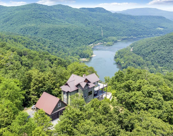
PRINCETON DEVELOPMENT PROPERTY
1134 Shelter Road, Princeton, WV | Lat/Lng: 37.3343, -81.1250
$495,000
18 ac.
10/24/2023
ACTIVE


Description
OVERVIEW
You could look far and wide and not find a property quite like this amazing investment opportunity, with two accesses to the property one on Shelter Road, and the other on Frontage Road just off 460 with high visibility and high traffic count. This property is ready to build apartment buildings, a mobile home park, single family homes or businesses. Just outside of the city limits, it can be used for commercial purposes or residential. The property has already been terraced, providing a lot of the ground work necessary to start the building process. Princeton Development Property offers amazing views to attract those potential buyers and customers.
LOCATION
Google Coordinates: 37.333015(N), -81.125682(W)
Address: 1134 Shelter Road, Princeton, WV 24740.
Elevation Range: 2560 ft. to 2703 ft. +/-
5 minutes to Princeton
10 minutes to Bluefield
20 minutes to Athens and Concord University
1 hour to Blacksburg, VA and Virginia Tech
10 minutes to Mercer County Airport, Bluefield
45 minutes to Beckley and Raleigh County Memorial Airport
Recreation:
10 minutes to Princeton Elks Golf Course
25 minutes to Camp Creek State Park & Forest
30 minutes to Pipestem Resort State Park
30 minutes to Winterplace Ski Resort
45 minutes to Bluestone Lake
MINERAL RESOURCES
West Virginia is one of the states in the US that has two ownership titles, those being SURFACE RIGHTS and MINERAL RIGHTS. A title search for mineral rights ownership has not been conducted. All rights the owner has will convey with the property. A mineral title search could be conducted by a title attorney at the same time when the surface title search is being conducted.
BOUNDARIES AND SURVEY
The property is being sold by the boundary and not by the acre.
ACCESS/FRONTAGE
The property is accessed by Shelter Road Rt. 19/32.
UTILITIES
Water: City water available at the road
Sewer: City service available at the road
Electricity: Available at the road
Telephone: Available at the road
Internet: Available through telephone company or satellite provider
Cellphone Coverage: Good
ZONING
The county is subject to some zoning and subdivision regulations. All prospective buyers should consult the County Commission and also the Health Department for details regarding zoning, building codes and installation of septic systems.
DEED AND TAX INFORMATION
Deed Information: DB 752 Pg. 297 less conveyances
Mercer County, West Virginia
Acreage: 18.03 acres +/-
Real Estate Tax ID/Acreage/Taxes:
Mercer County (28), West Virginia
Beaver Pond District (2)
Tax Map 14 Parcels 4.4 and 5; Class 3
2023 Total Real Estate Taxes: $338.38
PUBLIC SCHOOLS
Mercer County School District
Public Elementary School:
Glenwood School (K-8)
Public Middle School:
Glenwood School (K-8)
Public High School:
Pikeview High School
Higher Education:
Mercer County Technical Education Center, Princeton
Concord University, Athens
SURROUNDING AREA
HATFIELD-MCCOY TRAILS
The Hatfield-McCoy Trails System (HMTS) is made up of over 600+ miles of trails and located in the rich mountains of southern West Virginia. The 600+ mile HMTS is second only to the 2000 mile long Paiute ATV Trail in Central Utah.
As one of the largest off-highway vehicle trail systems in the world, HMTS is open 365 days a year and offers something for every skill level. The trail system caters to ATV, UATV, and motorbikes (dirt bikes), but hikers, mountain bikers, and horse riders can also use the trails. The trail system is a multi-county project, including West Virginia counties Logan, Kanawha, Wyoming, McDowell, Mercer, Wayne, Lincoln, Mingo, and Boone.
The name of the trail system is derived from the names of two families, the Hatfields and McCoys, who famously feuded near the West Virginia and Kentucky border after the Civil War.
Law enforcement officers patrol the trail to assure compliance with safety regulations. Motorized users of the trail system must wear a DOT-approved helmet and are prohibited from doubling (having a passenger), unless their vehicle is designed for two people. These rules, and a host of others, have allowed the trail system to enjoy a quality safety record, despite an increase in ATV-related injuries around the country.
The surrounding area offers unlimited soft recreational activities including white water rafting, golfing, fishing, camping, hiking, bird watching and rock climbing. Snow skiing at the Winterplace Ski Resort is a hour away. The Beckley Airport is just 45 minutes away. Yeager Airport in Charleston WV, is an easy 2 hour drive.
Blacklick Creek Forest is supported with the thriving community of Princeton. The area is a strong economic generator with a solid workforce employed in county/state government, tourism, hospitality, education, retail, construction, wood products, mining and agriculture. The surrounding area is richly blessed with a wide array of cultural events that keep life interesting and satisfying.
Charleston is West Virginias state capitol and is an easy 2-hour drive. Charleston is West Virginias largest city with a population of some 50,000 and a metro area of 225,000. It is the center of government, commerce, culture and industry. There is a commercial airport with daily flights to most major hubs.
Beckley is a 45-minute drive, has a population of 34,000, and is the county seat of Raleigh County. All amenities are available in Beckley. Beckley is located at the intersection of I-77, I-64 and US 19 so easy access to Charlotte, Pittsburgh, Charleston and Cincinnati is just around the corner.
The world renowned 4-Star Greenbrier Resort, home of the PGA tour, is an hour drive. Several other area golf courses are available in the area. The New River Gorge recreation area offers white water rafting, rock climbing, ziplining, camping and horseback riding. The nearby and very popular 100+ mile long Hatfield-McCoy ATV trail makes for a very active recreation area.
Year round, state maintained paved roads and a private driveway provide easy access. Weekly trash pickup, daily newspaper and daily mail delivery is available at curb-side. UPS and FedEx service this area also.
Situate within an hours drive of the confluence of the New River, Bluestone River and Greenbrier River, the 2000 acre Bluestone Lake, at Hinton is truly a gateway to water recreation. The 80,000 acre New River National River Park, Bluestone State Park, Pipestem State Park Resort and 17,000 acre Bluestone Wildlife Management Area are recreational cornerstones in the area. The new 10,000 acre Boy Scout high adventure camp is an hours drive.
THE NEW RIVER GORGE NATIONAL PARK and PRESERVE
The 70,000-acre New River Gorge National Park and Preserve is a unit of the United States National Park Service (NPS) designed to protect and maintain the New River Gorge in southern West Virginia in the Appalachian Mountains. Established in 1978 as a national river, the NPS-protected area stretches for 53 miles from just downstream of Hinton to Hawks Nest State Park near Ansted. The park was officially named Americas 63rd national park, the U.S. governments highest form of protection, in December of 2020, amid the COVID-19 pandemic as part of a relief bill.
West Virginia is home to parts of the Appalachian National Scenic Trail, a foot path that stretches more than 2,100 miles between Maine and Georgia; the Lewis & Clark National Historic Trail, which cuts through 16 states for 4,900 miles; the Bluestone National Scenic River; and Harpers Ferry National Historic Park. Now, over 70,000 acres of land, bordering 53 miles of the gorge, has earned the governments protection.
The New River Gorge National Park and Preserve is rich in cultural and natural history, and offers an abundance of scenic and recreational opportunities. New River Gorge is home to some of the countrys best whitewater rafting, mainly from the Cunard put-in to the Fayette Station take-out, and is also one of the most popular climbing areas on the East Coast.
Home to the New River, which drops 750 feet over 66 miles, with its Class V rapids, has long drawn adventuresome rafters and kayakers to this whitewater area. The New River, which flows northward through low-cut canyons in the Appalachian Mountains, is actually one of the oldest rivers on the planet.
Rock climbing on the canyon walls, mountain biking and hiking on trails that flank the river, and wildlife viewingbald eagles, osprey, kingfishers, great blue herons, beavers, river otters, wild turkeys, brown bats, snakes, and black bearsare all popular activities within the park.
Begin your experience with a stop at Canyon Rim Visitor Center, which is situated on the edge of the gorge, for maps, current information, and chats with a park ranger. You can learn any pertinent safety protocols and visit the bookstore.
The New River Gorge Bridge is a work of structural art. Construction of the bridge began in 1974, and was completed in 1977. The Bridge spans 3,030 feet in length and is the third highest bridge in the U.S., at 876 ft. During Bridge Day, an annual one-day festival celebrating the construction of the Bridge, BASE jumpers launch off the 876-foot bridge and parachute down to the New River. New River Gorge is the only national park in the U.S. that permits this extreme activity.
President Jimmy Carter signed legislation establishing New River Gorge National River on November 10, 1978 (Pub.L. 95625). As stated in the legislation, the park was established as a unit of the national park system for the purpose of conserving and interpreting outstanding natural, scenic, and historic values and objects in and around the New River Gorge, and preserving as a free-flowing stream an important segment of the New River in West Virginia for the benefit and enjoyment of present and future generations. The New River Gorge National Park and Preserve Designation Act was incorporated into the Consolidated Appropriations Act, 2021, changing the designation to New River Gorge National Park and Preserve. L
Details
County: Mercer
Zipcode: 24740
Property Type One: Residential Property
Property Type Two: Undeveloped Land
Brokerage: FoxFire Realty
Brokerage Link: www.foxfirenation.com
Apn: 02-14-5

Richard Grist
FoxFire Realty
(304) 645-7674
By clicking the button, you agree to our Terms of Use and Privacy Policy.


Nearby Listings
Mercer County, WV

$1,750,000 - 994 ac.
Raleigh County, WV

$549,000 - 60 ac.
Carroll County, VA

$299,900 - 33 ac.
Raleigh County, WV
$2,600,000 - 408 ac.
Summers County, WV
$699,000 - 230 ac.
Summers County, WV

$2,200,000 - 140 ac.
Giles County, VA

$1,050,000 - 154 ac.
Greenbrier County, WV

$325,000 - 9 ac.
Summers County, WV

$220,000 - 45 ac.
Monroe County, WV

$325,000 - 113 ac.