
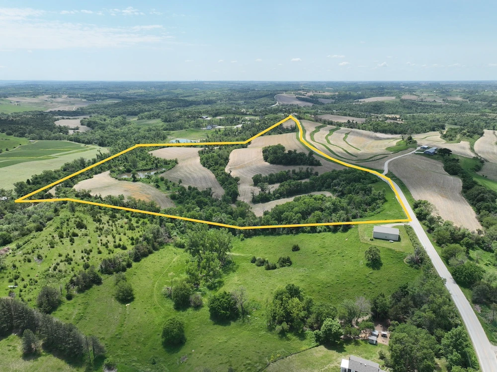
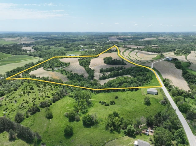
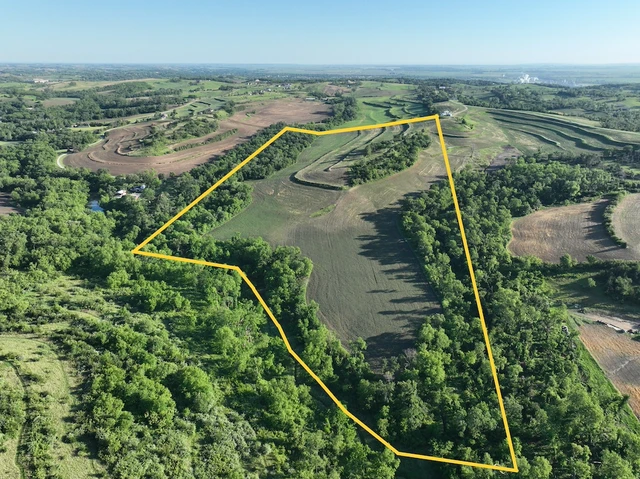
Rural Parcel Blair Hills
TBD, Road P35, Blair, NE | Lat/Lng: 41.5034, -96.1154
$4,844,000
179 ac.
06/04/2026
ACTIVE
Description
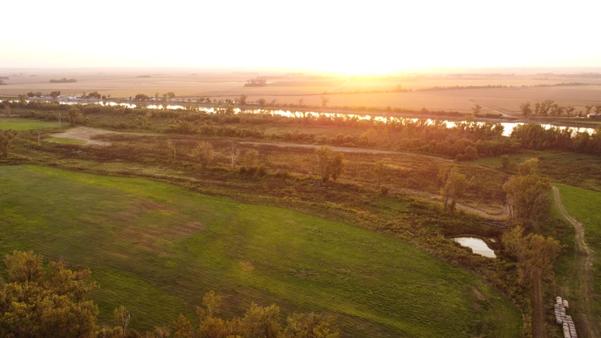
Located in the countryside of Washington County, Nebraska, this expansive 179 acre multi-tract property presents an extensive land opportunity situated just outside the city of Blair. This offering consists of four total tracts being made available as a single, contiguous whole. The size and composition of this land make it highly adaptable for an investment portfolio, a large-scale private estate, or a functional combination of agriculture and outdoor recreation. The physical landscape features the classic rolling topography of the region near the Missouri River Valley, creating high ground with wide views of the surrounding valley and agricultural countryside. A network of wooded draws with mature trees intersects the open spaces, providing excellent natural cover, bedding ground, and travel corridors for local wildlife. A small pond on the property supplies a dependable year-round water resource for regional game birds and animals, making the entire 179 acres a highly capable recreational property and hunting land. Beyond its prominent recreational value, the land maintains a strong connection to agricultural production. Significant portions of the acreage are currently farmed, generating stable annual agricultural crop income or cash rent lease opportunities. This active cultivation keeps the open ground productive, provides immediate returns for an investor, and naturally serves as a food source that keeps local wildlife populations consistent across the acreage. For buyers focused on residential development or custom estate planning, the property features a varied topography that includes multiple potential building locations. Subject to standard Washington County zoning and building permit approvals, these elevated positions offer clear building sites that overlook the valley landscapes. The layout provides the space and flexibility to establish one major private homestead with supporting outbuildings, or to manage the land as separate independent parcels utilizing direct paved frontage of County Road P35. While the acreage provides a quiet, low-traffic environment, it sits just miles south of downtown Blair, keeping daily amenities, school systems, grocery markets, and medical services within convenient reach. Furthermore, the property is located approximately 20 miles north of the Omaha metropolitan area, offering a highly practical balance between rural living and modern urban conveniences. Exact acres subject to survey. This property is exclusively co-listed for sale by Whitetail Trophy Properties Real Estate and NP Dodge Real Estate. All property inquiries, showings, and offer submissions are handled jointly by the co-listing agents representing both brokerages.
Details
County: Washington
Zipcode: 68008
Property Type One: Farms
Property Type Two: Recreational Property
Property Type Three: Residential Property
Brokerage: Whitetail Properties Real Estate
Brokerage Link: https://land.com

Billy Chromy
Whitetail Properties Real Estate
(402) 277-0024
By clicking the button, you agree to our Terms of Use and Privacy Policy.


Nearby Listings
Harrison County, IA
$415,000 - 1 ac.
Washington County, NE

$575,000 - 10 ac.
Washington County, NE

$1,040,000 - 40 ac.
Washington County, NE

$1,590,000 - 53 ac.
Washington County, NE

$858,000 - 33 ac.
Washington County, NE
$1,378,000 - 53 ac.
Saunders County, NE

$449,000 - 132 ac.
Harrison County, IA

$618,740 - 33 ac.
Burt County, NE
$1,665,414 - 308 ac.
Douglas County, NE

$1,600,000 - 31 ac.