

T Diamond Ranch
206 Lower Red Water Creek Road, Beulah, WY | Lat/Lng: 44.5687, -104.0667
$5,000,000
432.96 ac.
07/23/2026
ACTIVE
Description
T Diamond Ranch. 432.96 deeded acres on Lower Redwater Creek in the western Black Hills of Wyoming. Irrigated hay meadow, native pasture, timbered ridges, and a cold-water trout fishery. A 2001 custom entertaining residence of approximately 7,000 sq ft and a 1930s headquarters compound anchor the working cattle and hay operation. Two miles north of Beulah, 20 minutes east of Spearfish, South Dakota. Perpetual conservation partnership in place.
Land
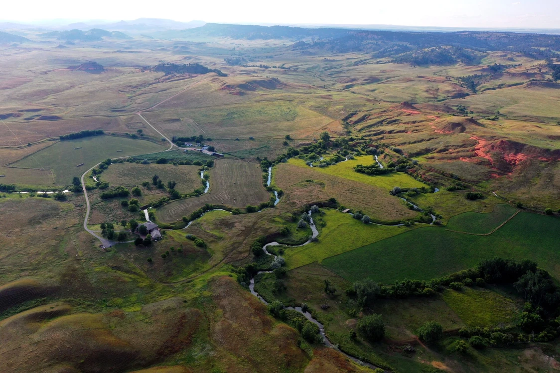
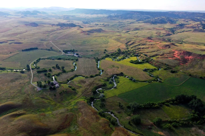
T Diamond Ranch consists of 432.96 deeded acres tucked into the western folds of the Wyoming Black Hills, two miles north of the quiet ranching community of Beulah and only 20 minutes east of Spearfish, South Dakota. The ranch lies at 206 Lower Redwater Creek Road in Crook County, and Lower Redwater Creek runs cold and clear the entire length of the property.
The land is a tapestry of irrigated hay meadow along the creek, native pasture rolling through gently undulating draws, riparian corridors shaded by cottonwood and oak, and ponderosa pine ridges that frame the valley. Approximately 125 acres of fertile bottom ground sit along Lower Redwater Creek, with the balance of the acreage in productive grazing ground and timbered cover.
The perimeter of the property is fenced, with cross fencing that supports rotational grazing across the pasture and timbered units. The combination of creek bottom, open pasture, and timbered ridge gives the ranch both working productivity and true seclusion with everyday accessibility.
Improvements
The 1930s headquarters is the working heart of the ranch and a record of nearly a century of stewardship. The original 3-bedroom 1-bath farmhouse, the historic dairy barn, and the working corrals stand as they have for generations, with a shop building and attached living quarters supporting modern operations. These structures are not relics. They are part of the working ranch, maintained and ready.
Across the creek and a short distance up the bench sits the 2001 custom entertaining residence, the lifestyle anchor of the property. Approximately 7,000 sq ft of total finished area unfolds across the home with a full finished walkout lower level and a finished upper level. The home is built for entertaining and family use, with expansive gathering spaces, 3 bedrooms and 7 bathrooms, and large windows that frame the surrounding ranchland and the creek bottom below.
Additional improvements include two registered wells, one of which is a flowing artesian well, a permanent stock water pipeline easement appurtenant to the ranch, perimeter fencing with cross fencing, and fiber optic broadband along the County Road 142 frontage that supports full remote work capability at the residence. Together, the historic compound and the modern residence give a new owner the working infrastructure of a ranch and the comfort of a home built for hosting.
All existing improvements are fully grandfathered under the conservation partnership and may be maintained, repaired, and reconstructed in kind.
Recreation
For the avid outdoorsman, T Diamond Ranch is a private sanctuary. Lower Redwater Creek runs cold and clear the length of the property, holding wild brown and rainbow trout in its undercut banks and shaded riffles. Quiet pools beneath the cottonwoods give way to gravel runs that test the angler with the kind of fly fishing most people travel hundreds of miles to find. Here, it is a hundred yards from the porch.
The hay bottoms and timbered draws hold abundant wildlife year-round. Whitetail deer, mule deer, Merriam's turkey, and elk move freely between the Black Hills National Forest and the creek corridor, drawn by the water, the cover, and the food the ranch quietly produces. Upland birds work the field edges and waterfowl frequent the creek through the season. The ranch falls in Wyoming Game and Fish hunt areas applicable to Crook County and offers excellent opportunity for bow, rifle, and shotgun across multiple species.
Beyond the boundary, the western Black Hills open into a vast playground of public land, with horseback riding, hiking, mountain biking, and backcountry skiing all within a short drive. The conservation partnership permits and protects noncommercial recreation on the ranch, including hunting, fishing, horseback riding, and backcountry exploration. Whether you are stalking the timber with a bow or simply glassing the hills from a porch chair with morning coffee, this land rewards patience and presence.
Agriculture
T Diamond Ranch has supported a working cattle and hay operation for nearly a century, and the infrastructure is in place to continue that tradition seamlessly. Approximately 125 acres of riparian and irrigated hay bottom along Lower Redwater Creek produce one to two cuttings of grass and grass legume hay each season under the Miller Ditch surface water right.
The remaining acreage rolls through productive pasture and timbered grazing, fully fenced on the perimeter and cross fenced for rotational management. Estimated carrying capacity ranges from 30 to 45 cow calf pairs on a year-round basis under good management, factoring the higher producing irrigated bottom ground and the more conservative wooded ridges.
Working corrals at the historic headquarters accommodate cattle handling, sorting, loading, and horse care. The ranch is suited for a continued cattle and hay operation, a horse operation, or a lifestyle ranch that runs a smaller herd and holds the hay for winter feed. The land is zoned for agriculture, supporting a favorable property tax structure under Wyoming's agricultural valuation framework.
Water/Mineral Rights & Natural Resources
Water is the central asset of T Diamond Ranch. Lower Redwater Creek flows the length of the property and provides live water for stock and fishing. The Miller Ditch delivers surface irrigation to the hay meadow.
Two registered wells serve the headquarters. The Matthews A well, drilled to 700 feet, is permitted at 25 gallons per minute for domestic and stock use, with a static water level of 20 feet. The Matthews #1 well is a flowing artesian well drilled to 1,745 feet for domestic supply. A permanent stock water pipeline easement, recorded in Crook County records, runs from a wellhead across the adjoining property under a 20-foot-wide underground easement appurtenant to T Diamond Ranch and delivers year-round stock water to the southern grazing units.
Any mineral rights currently owned by the Seller will convey with the sale, subject to the conservation partnership's restrictions on surface impacting extraction.
Natural resources across the ranch include the riparian corridor of cottonwood and oak along Lower Redwater Creek and the ponderosa pine ridges that frame the valley, together with the wildlife habitat and cold-water fishery those resources sustain. The conservation partnership permits water development for ranching purposes and protects the ecological richness of the Lower Redwater Creek corridor in perpetuity.
General Operations
The ranch operates as a working cattle and hay unit with the infrastructure in place for a seamless transition. The perimeter is fenced and the interior is cross fenced for rotational grazing. Working corrals at the historic headquarters handle sorting, cattle work, and horse care, and the shop building with attached living quarters supports day to day operations. The permanent stock water pipeline easement carries year-round stock water to the southern grazing units, and the Miller Ditch delivers irrigation water to the hay meadow.
T Diamond Ranch was placed under a perpetual conservation partnership with The Nature Conservancy in 1998. The partnership permits and protects the very activities that make this ranch what it is: cattle and livestock grazing, hay production, water development for ranching purposes, fencing and structure maintenance, and noncommercial recreation. All existing improvements are fully grandfathered and may be maintained, repaired, and reconstructed in kind. The ranch will not be subdivided, and the vistas across the creek and into the timbered ridges will not be carved up by neighboring development. The conservation framework also supports a favorable agricultural property tax structure.
The Seller is making known to all potential purchasers that there may be variations between the deeded property lines and the location of the existing fence boundary lines on the subject property. The Seller makes no warranties with regard to the location of fence lines in relationship to the deeded property lines, nor does the Seller make any warranties or representations with regard to specific acreage within the fenced property lines. The Seller is selling the property in an as is condition, which includes the location of the fences as they exist. Boundaries shown on accompanying maps are approximate based on the legal description and may not indicate a survey. Maps are not to scale and are for visual aid only. Their accuracy is not guaranteed.
Region & Climate
T Diamond Ranch enjoys a classic four-season High Plains climate, marked by warm, sunny summers ideal for hay production, crisp autumns perfect for hunting and harvest, snowy winters softened by abundant sunshine and low humidity, and vibrant springs that recharge the creek and ditch. Average annual precipitation runs 20 to 25 inches and the area enjoys approximately 200 days of sunshine each year. Growing season is approximately 120 days, supporting hay and pasture production along with seasonal vegetable gardens at the headquarters.
The ranch sits at the western edge of the Black Hills, a region long recognized as one of the most diverse landscapes in the American West. Timbered ridges give way to open prairie within a few miles of the ranch, and the surrounding country carries the character that has drawn people to this corner of Wyoming for generations. Spearfish Canyon, the Black Hills National Forest, Devils Tower National Monument, and the historic mini
Details
County: Crook
Zipcode: 82712
Property Type One: Farms
Property Type Two: Ranches
Property Type Three: Horse Property
Brokerage: Hayden Outdoors Real Estate
Brokerage Link: www.haydenoutdoors.com/agents/kerry-engelmann/
Apn: 53602010001700

Kerry Engelmann
Hayden Outdoors Real Estate
(605) 484-4325
By clicking the button, you agree to our Terms of Use and Privacy Policy.


Nearby Listings
Pennington County, SD

$699,000 - 7 ac.
Crook County, WY

$64,900,000 - 33934 ac.
Crook County, WY

$15,000,000 - 3429 ac.
Crook County, WY

$799,000 - 24 ac.
Butte County, SD
$12,889,448 - 1308 ac.
Lawrence County, SD

$1,490,000 - 5 ac.
Butte County, SD

$1,152,000 - 640 ac.
Crook County, WY

$4,450,000 - 520 ac.
Crook County, WY

$1,324,000 - 40 ac.
Lawrence County, SD

$219,000 - 3 ac.