

Four Oaks Ranch On Antelope Creek
County Road 266, Richland Springs, TX | Lat/Lng: 31.3844, -99.0310
$2,965,000
395.23 ac.
08/27/2026
ACTIVE
Description
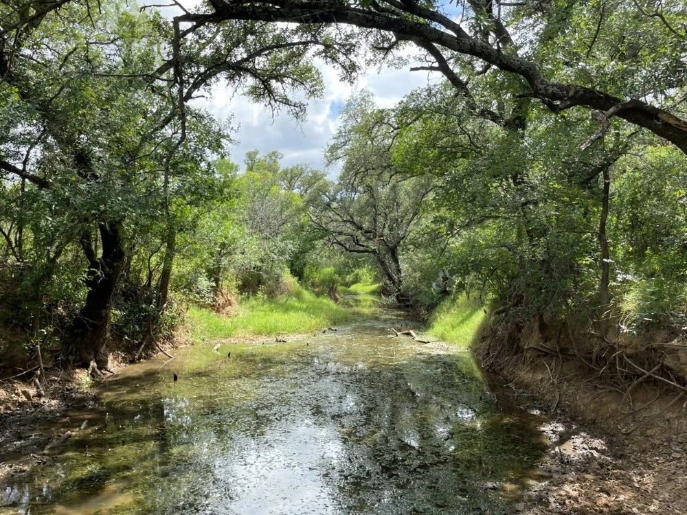
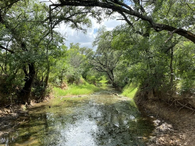
FOUR OAKS RANCH ON ANTELOPE CREEK offers history, diversity and a unique water resource. Productive ground once in cultivated fields and coastal pasture now provides native mesquite-cover habitat while a mixture of mature oaks shade the field perimeters and line the creek bottom. Antelope Creek provides an interesting drainage feature and wildlife corridor as it meanders through the landscape. While most of its sandy gravel bottom carries wet-weather flows, the northern stretch of the creek is fed a steady stream of water by an artesian well located on the north central portion of the property. Earthen stock tanks are distributed across the southern portion providing additional surface water for both livestock and wildlife. Four Oaks Ranch offers food plot and forage production potential to suit your recreational and livestock endeavors along with opportunity to expand surface water amenities.
LOCATION/FRONTAGE: The property is located on the west side of County Road 266 approximately 0.5 mile south of Ranch Road 765 and about 10 miles northwest of Richland Springs in San Saba County, Texas. The property has about 5,420 feet of frontage along County Road 266.
LEGAL: 395.23 acres out of the Fisher & Miller Survey No. 630, A-299 and the Frederich Kneese Survey No. 86, A-772 in San Saba County, Texas.
UTILITIES: Richland Springs Special Utility District (SUD) maintains a 4-inch water line along CR 266 with a meter already supplying water to the property. An artesian well is located on the north central portion of the property, offering additional possibilities.
SCHOOL DISTRICT: Richland Springs ISD
TAXES: Agricultural use valuation on 394.23 acres with a grazing tenant in place. (San Saba CAD Parcel Nos. 1037, 2981 & 2982).
MINERALS (OIL & GAS): The property has no existing, or historic oil or gas production with minimal mineral activity present in the surrounding neighborhood. Owner is believed to have a partial interest in mineral estate, and conveyance is negotiable.
FLOOD PLAIN: Approximately 85 acres (±22%) is within the 100-year flood plain of Antelope Creek according to FEMA Panel No. 48411C0025 dated July 2, 1991.
EASEMENTS: Typical utility easements for water, electricity and telephone/internet service.
IMPROVEMENTS: The historic home is situated on the northeast portion of the property about ±250 feet from the road frontage. This wood frame dwelling contains 2,325 SF covered by a composition shingle roof. The unique exterior walls are covered by a petrified wood veneer. Covered porches located on the northern and southeastern elevations of the dwelling combine for a total of 421 SF. The structure is divided into east and west portions with a sunroom hallway connecting the two areas. The main living area is located on the east end and is built on a pier and beam foundation, making up about 75% of the overall structure. The sunroom and secondary living space form the balance of the dwelling and are built over a concrete slab. The house provides four bedrooms and two baths along with a kitchen, dining area, living room and utility room. Window units provide air conditioning while heating is provided by two fireplaces and space heaters.
A matching two-story 1,220 SF detached garage is connected to the house by a covered breezeway. The ground level contains 610 SF with two parking bays accessed by overhead garage doors. The upper level is accessed by an exterior staircase and consists of an apartment/game room with a closet and full bathroom.
These structures were reportedly built in the mid-1940’s and with a little work could be restored to reveal their true character. The owners have historically used the dwelling for extended weekend stays.
Site improvements include a network of earthen pasture roads and fencing. The low-fenced perimeter is a mixture of barbed and net wire on a combination of wood and steel posts. The fences range from good to fair condition.
COMMENTS: Antelope Creek meanders for about 1½ miles through the property draining from south to north. The northern ¼-mile stretch of this stream is fed by an artesian well on the property which trickles a steady flow of water for about 700 feet along a draw to the creek bed, keeping this portion of the creek wet throughout the year. The remaining southern stretch of Antelope Creek provides wet-weather flows over a sandy gravel bottom, contributing to land diversity and wildlife habitat. Several earthen stock tanks are distributed throughout the property for livestock water and provide a combined ±¾-acre of surface water when full. A soil conservation lake (known as Southeast Laterals Watershed Reservoir No. 4) is located mostly on the neighbor's property to the west. The lake dam is located inside the western boundary with a narrow sliver of the lake being inside the property’s boundary line. The property’s upland portions reveal a desirable mixture of scattered to densely wooded native pasture with remnants of approximately 120 acres of former coastal fields spread through the middle of the tract. While the fields have reverted to re-growth mesquite pasture, they could be restored for grazing or strategically cleared for use as food plots. Either way the old fields facilitate habitat edge effect for wildlife. A mixture of oak, elm, hackberry and mesquite trees provide shade canopies with greater densities observed along the drainage ways and sloped areas. The level to gently rolling topography produces about 70 feet of total elevation change over sandy loam soils.
Details
County: San Saba
Zipcode: 76871
Property Type One: Ranches
Property Type Two: Recreational Property
Property Type Three: Hunting Land
Brokerage: Mays Landmark Real Estate Services, LLC
Brokerage Link: www.mayslandmark.com

Michael Mays
Mays Landmark Real Estate Services, LLC
(737) 340-5182
By clicking the button, you agree to our Terms of Use and Privacy Policy.


Nearby Listings
McCulloch County, TX

$6,711,500 - 2165 ac.
San Saba County, TX

$189,900 - 12 ac.
McCulloch County, TX

$1,250,000 - 123 ac.
McCulloch County, TX

$1,010,500 - 101 ac.
Coleman County, TX

$7,199,141 - 1481 ac.
McCulloch County, TX

$1,033,700 - 103 ac.
McCulloch County, TX

$1,070,400 - 107 ac.
San Saba County, TX

No Price - 600 ac.
San Saba County, TX

$4,995,000 - 379 ac.
Coleman County, TX

No Price - 120 ac.