

Tater Mountain West
Tater Mountain West, Dardanelle, AR | Lat/Lng: 35.2296, -93.2902
$300,000
30 ac.
07/15/2026
ACTIVE
Description
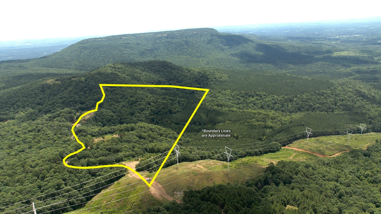
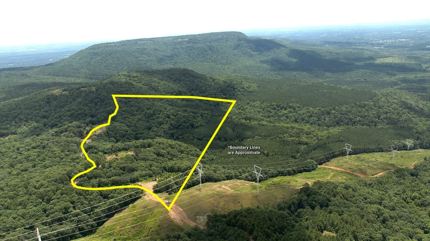
Tater Mountain West is a 30± acre development tract situated at the peak of Tater Mountain, offering three graded, build-ready homesites with long-range views across the Arkansas River Valley. From the primary homesite, the views stretch east to Mount Nebo, west across Spring Mountain, and south toward the Ouachita Mountains.
Years of planning and site preparation have already been completed, with three leveled building locations positioned to maximize both privacy and views. Rather than starting with raw ground, the next owner can begin designing and building immediately while preserving the surrounding mature hardwood forest that defines much of the property’s character.
One of the more unique features of the tract is a rare Indian Trail Marker tree located beside one of the homesites. Combined with approximately 86% mature hardwood timber, the property offers a setting that is both scenic and historically interesting.
Located just over one mile from Mount Nebo State Park and approximately one mile from the public John Harris Field Airport atop Spring Mountain, the property provides convenient access while maintaining the privacy expected from a mountain retreat. Whether intended as a primary residence, weekend getaway, or vacation home, the combination of established build sites, expansive views, and surrounding public recreation creates an opportunity that is increasingly difficult to find.
Tater Mountain West is one of three tracts being offered from the larger Spring Mountain Estate development area, alongside Tater Mountain East (30± acres) and Tater Mountain North (40± acres). A new survey will be completed prior to closing, with the seller agreeing to pay one-half of the survey cost. Electricity is available nearby, access is provided by a privately maintained shale/gravel road, and a community well will be needed for water service.
Location Description
Tater Mountain West is positioned on a high-elevation ridge line known as "Tater Mountain" between Spring Mountain and Mount Nebo State Park in the Arkansas River Valley. Located less than two hours from Little Rock and one mile east of the public John Harris Field Airport. This 30-acre tract features three pre-graded build sites with panoramic views of Mount Nebo to the east, Spring Mountain to the west, and the Ouachita Mountains to the south.
Highlights
Three graded, build-ready homesites with expansive views of Lake Dardanelle, Mount Nebo, Spring Mountain, and the Ouachita Mountains
30± acre mountain tract with approximately 86% mature hardwood forest
Rare Indian Trail Marker tree located beside one of the established homesites
Located just over one mile from Mount Nebo State Park and approximately one mile from John Harris Field Airport
Electricity available nearby with access provided by a privately maintained shale road; community well needed
Offered as one of three development tracts within the larger Spring Mountain Estate
Senior Advisor: Greg L. Hay 501-470-5091
Details
County: Logan
Zipcode: 72834
Property Type One: Recreational Property
Property Type Two: Timberland
Property Type Three: Hunting Land
Brokerage: Saunders Land
Brokerage Link: land.saundersrealestate.com/about/land-advisors/david-hill/

David Hill
Saunders Land
(479) 879-1476
By clicking the button, you agree to our Terms of Use and Privacy Policy.


Nearby Listings
Perry County, AR

$1,097,250 - 275 ac.
Logan County, AR

$1,300,000 - 100 ac.
Johnson County, AR
$1,800,000 - 173 ac.
Logan County, AR

$59,900 - 6 ac.
Yell County, AR

$7,168,000 - 1579 ac.
Logan County, AR

$299,000 - 103 ac.
Logan County, AR

$126,360 - 40 ac.
Pope County, AR

$387,500 - 89 ac.
Logan County, AR

$99,000 - 5 ac.
Conway County, AR

$395,000 - 84 ac.