Okanogan County, Washington Land For Sale (49 results)
Want to post your listings on AcreValue? View Listing Plans
AcreValue offers multiple types of land for sale in Okanogan County, so if you’re looking for a new ranch, farm, recreational property, hunting ground, developmental property, or land investment you’ve come to the right place. Regardless of what your needs or objectives are for your land, we have a large inventory of available parcels that are updated regularly. Therefore, it’s very likely that we have the perfect parcel that meets all the search criteria & specifications that you’ve been searching for. Additionally, because our land for sale listings are always being updated due to the frequency of land being sold or new land listings being put on the market, make sure that you are checking back with AcreValue regularly for updates. When you find the perfect land parcel and you are ready to take the next steps you can easily connect directly with the listing agent to help you facilitate your land purchase. Browse AcreValue's Washington land for sale page to find more potential opportunities in Washington that fit your needs. We wish you the best of luck in finding your next ranch, farm, recreational property, hunting ground, developmental property, or land investment.

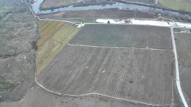
12/09/2025
$845,000
93.52 ac.
ACTIVE
Okanogan County - 27 South Janis Road, Tonasket, WA
This 93.52-acre agricultural offering along S. Janis Road in Riverside, WA features a diverse blend of organic andconventional ground with strong production potential and valuable water access from the Okanogan River. The property includes 8 acresof organic Bosc pears, 12 acres of conventional D'Anjou pears, 5 acres of conventional Bartletts, 4 acres of organic Granny Smith, 1acre of organic Honeycrisp, 21 acres of certified organic open ground, and 42.53 acres of dryland/mountain terrain, creating a versatileoperation suitable for tree fruit, organics, and expansion. Water is supplied by a river pump (no meter) plus a domestic well serving theon-site manufactured home. Improvements include a pole-built shop and a doublewide manufactured home, along with five Orchard-Ritewind machines to support frost protection. With its mix of established crops, organic acreage, existing infrastructure, and scenic riverfrontsetting, this property offers a rare opportunity for growers, investors, or those seeking a productive agricultural holding in the Okanoganregion. This property is across the road from rail. Irrigation water is sourced directly from Okanogan River.This listing includes 5parcels:#3627041002#3627034005#3627040011#3627033006#3627033005


07/08/2020
$2,225,000
430.89 ac.
ACTIVE
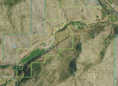
Okanogan County - 240 McFarland Creek Road, Methow, WA
This exceptional Mountain Ranch offers 430+ ac. of stunning rural living. Secluded & private, access by county road or plane w/2,600 ft airstrip that can be extended to 4000 feet. 80 ac. of irrigated farmland, rich soil, & hundreds of ac. of wooded mountainside/trails. 1 bed, 1 bath home w/garden, deck,& patio. 29 X 40 shop, w/ 3 phase pwr & ample workspace. Limitless recreational fun just outside your door! Space for 2 addit. homes, RV hook-ups, 3 ponds, McFarland Creek Frontage. Adjudicated water rights for irrigation and domestic well water usage. This could be your slice of paradise!

05/29/2024
$84,899
40 ac.
ACTIVE
Okanogan County - McLaughlin Canyon Rd, Tonasket, WA
40-Acre Mountain Retreat with 758-Acre BLM Easement and Prime Mule Deer Hunting in Tonasket, Washington
Cash Price: $84,899
Owner Financing: $14900 down, then $782.22 per month for 180 months (includes principal, interest and processing).
Reservation Fee: $900 non-refundable reservation fee secures this property. Reservation fee will be counted toward purchase price or down payment.
With your Purchase You Get:
1. CLEAN Title with a Deed in Your Name
2. BUILD on your Land During the Financing Period
3. LIVE on your Land and Run Utilities During the Financing Period
4. NO CLOSING FEES if you Close Directly In-House with our BBB A+ Rated Sales Team
BBB A+ Rating Business: We are Better Business Bureau Accredited Company with an A+ Gold Star Rating. We pride ourselves on giving our customers all of the history and results of our deep-dives on the properties they are interested in so that they can make the most informed purchasing decision. Our properties are hand-picked based on features that hold value. Call or Email us Today to Learn More about our streamlined buying experience.
Buyer Due Diligence: We do our best to ensure listing accuracy. However, buyer is responsible to perform their own due diligence and verify all information, contained herein or not, including access and utility accessibility and costs, and physically visit the property. Property is sold AS IS.
Seller Pays all Closing Costs.
Close to Town:
Located just 15 minutes from Tonasket, WA (great pizza, thai food, coffee, banking, hospital, school, ag stores, building supplies, shipping, and even a new cannabis shop) and 15 minutes from a top quality Deer Processor (Dick Mickey's), this property makes the perfect location for adventure, views, and close access to town.
Mule Deer Heaven:
The mule deer population is outstanding. The ranch is located within Game Management Unit 204, ranked the best county in Washington State for top scoring Mule Deer. Contact us for a private viewing of our owner's trophy shots. Check out the county's hunting prospects guide here. There are also 2 seasons annually (a Spring and Fall season) for black bear.
You are within 15 minutes of custom deer processing that provides a variety of flavors, cuts and options and 30 minutes from our taxidermy friends that live on an Indian reservation.
Clean Title and Exclusive Public Land Access:
As a new owner, you will receive a warranty deed and survey + an exclusive pedestrian easement to 758 acres of neighboring Public Bureau of Land Management (Blm) Land that connects to our main road. This 758 acres is landlocked in the mountains and only accessible from our private road. This is the opportunity you've been waiting for to get a piece of the mountain + be able to hunt large acreage that is lesser known to the general public.
Driving Conditions:
The property itself is accessible all the way up the mountain by our private road which intersects with McCaughlin Canyon Road. Check our driving directions and photos for pictures of the gate and survey. We have installed a circular turnaround pad and driveway directly onto the property where conditions are best for parking, cabin installation and a view over the town. You can drive there by 2WD during the Spring, Summer and Fall. In heavy rain seasons or Winter, we recommend 4WD just in case for seasonal mud and snow. In Heavy Snow conditions we do not recommend driving at all, use a snowmobile or walk. Sections of the road that experience the most annual wear and tear have been graveled; overall road conditions are good. The road is generally at least 6' wide all the way to the top and we have been able to successfully haul cabins and heavy trucks all the way up.
There are 2 Options for Water:
Well Drilling and Spring Water (Can be Unpredictable): Results are mixed across the entire development on the availability for well water. Currently across the 890-Acre ranch, 2 of the tracts have producing wells, another 2 have shallow water hand-dug wells, 1 tract has a dry well, and 3 remaining tracts have above-ground flowing spring-fed water. There is the possibility for addition springs to run underneath the ground but where they are and if they produce can be unpredictable. The producing wells have ranged from 180' in depth to 540' in depth. The dry well is approximately 300' deep. See well reports and producers in our land report below.
Bulk Water Storage from Tonasket (Recommended): Both the Ace Hardware store and Lee Frank Mercantile Store in Tonasket offer solutions to purchase bulk water storage containers and options for pickup and delivery. This is a very affordable and sanitary approach for seasonal recreational usage compared with drilling a new well. 325 Gallon Tanks run ($400) and 2,500 Gallon thanks run ($1,500). Water is sold at an approximate rate of $651 per 500 Gallons (subject to change).
History of McCloughlin Canyon:
Just down the street from this property, you will drive past a lookout point in the canyon where a historical marker is placed. In July 1958, a group of indians (upset by an increasing flow of miners heading for gold fields) lay in ambush through the length of the canyon. As 150 men led by David McCloughlin approached from the south, the warriors camouflaged their stone breastworks with branches. But their wilted leaves alerted McCloughlin's advance party so the Indians opened up prematurely. Firing continued for several hours near the mouth of the canyon. Three miners were killed. The caravan retreated to the Okanogan river and next day crossed over in rafts.
Ag Exemption:
40 acres land for sale in Okanogan, Washington benefits from an agricultural exemption with a small herd of cattle grazing the overall mountainside to keep the property taxes low and grass growth down to protect the land from wildfire risk.
Cell Service and Internet:
Excellent reception at the top of the mountain with good speeds from Verizon, At&T & T-Mobile enabling you to FaceTime off the bluff views. Service along the county road entrance and initial drive up the lower parts of the road is much more challenging. We recommend turning your GPS On before driving up McCaughlin Canyon road in case you temporarily lose service. Internet is best recommended through Starlink Satellite. Connection speeds reach up to 150 BPS with hardly anyone else pointing towards that satellite in this area.
Recreational Purpose:
This ranchette enjoys low but sensible restrictions, allowing numerous uses:
Yurt and Cabin Builds and Commercial Rentals
Full Time Rv
Any Permanent Structures
Tiny Homes
Camping
Basic restrictions are in place to ensure properly handling of waste and wastewater, not leaving fires unattended, hunting or shooting on or over the easement roads, maintaining easement roads, and not using tents and lean-tos / shanties as permanent residences.
One of our customers built a yurt and deck with propane powered water heater and composting toilet. Check out the Sleepy Sasquatch below: (Link)
Land Details:
No Hoa
No Minimum building size
Water: 325 Gallon ($400) and 2,500 Gallon ($1,500) tanks available for purchase at nearby Tonasket Ace Hardware, Lee Frank Mercantile (509) 486-2105. Also sell water at $651 per 500 Gallons.
Electricity: Okanogan Public Utility District. Call for cost estimates of getting power to your property. - 509-422-3310
Satellite internet services: Internet is best recommended through Starlink Satellite. Connection speeds reach up to 150 BPS with hardly anyone else pointing towards that satellite in this area.
Curbside Trash Service: by Upper Valley Disposal Call (509) 476-3910
Tonasket School District : Elementary, Middle School, & High School
Nearby College: Wenatchee Valley College
Elegment ID: Llp_Wa_Tract-Mm
Address: McLaughlin Canyon Rd, Tonasket, Okanogan County, Washington, 98855
Gps: 48.65527, -119.42542
Parcel Number: 3727343003
Size: 40 Acres
Dimension: 1331 ft x 1410 ft
Title: Free & Clear, Warranty Deed
Zoning: Resource - Agriculture Current Use
Taxes: $51.88 per year
Successful Wells and Completion Dates:
Robert Thompson
Okanogan Drilling
County: Okanogan
Well Report ID: 148058, Well Tag Id:Acb607, Notice of Intent Number: W050165
Well Diameter: 6 in. , Well Depth: 540 ft.
Well Type: Water
Well Completion Date: 09-30-1996
Company: Fogle Pump and Supply
Tax Parcel Number: 3627021005
County: Okanogan, Well Address: Tbd, Tonasket
Well Report ID: 1887049, Well Tag Id:Blg913, Notice of Intent Number: We33384
Well Diameter: 6 in. , Well Depth: 180 ft.
Well Type: Water
Well Completion Date: 11-15-2018, Well Report Received Date: 12-13-2018
Nearby Cities & Points of Interest
We've put together a complete google list of activities for your convenience: [Click Here]
15 Minutes to Tonasket, Wa
30 minutes to Walmart Supercenter
30 minutes to Omak City
32 minutes to Wenatchee Valley College North
36 minutes to Sinlaheken Wildlife Area
37 minutes to Okanogan Valley Golf Club
38 minutes to Conconully Lake
38 minutes to Lake Osoyoos and Canadian Border
40 minutes to Bannon Mountain Trailhead
44 minutes to Omak Lake
48 minutes to Fourth of July Trailhead
1 hour to Loup Ski Bowl
1 hour 43 minutes to North Cascades Heli Skiing
3 hours 10 minutes to Spokane, WA & GEG International Airport

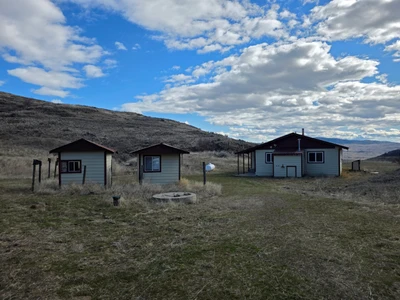

03/24/2026
$295,500
200 ac.
ACTIVE
Okanogan County - 105 Emily Rd, Oroville, WA
200 acres with five tax parcels. 2-bedroom, 1-bath, full kitchen, livable Cabin plus two bunk houses and a large 2-door shop. Private setting, no visible neighbors, 200 acres with five tax parcels. A 2-bedroom, 1-bath cabin plus two bunkhouses and a large 2-door shop. Private setting with no visible neighbors. Great location, 20 minutes from town.
Land
200 acres of rolling land overlooking the valley below.
Improvements
Home is 1036 sq ft. The shop is 3036 with two 10ft doors. 300-foot well. 2 bunk houses, 812 each.
Recreation
Great property for horseback riding, ATVs , deer hunting , or just hiking around. tens of thousands of acres of public land near multiple lakes and rivers.
Agriculture
Good property for some livestock, you will need to fence it.
Region & Climate
North Okanogan (Washington/BC border region) features a continental climate with hot, dry summers and cold, snowy winters. Summers often see temperatures above 80 90 degrees
while winters bring freezing temperatures and significant snowfall, particularly in the highlands, with valley temperatures ranging from 6-33 degrees
Location
Oroville is 20 minutes away, with grocery stores, a hospital, restaurants, and everything else you need. Omak is 40 minutes away and has a Walmart and a Home Depot.

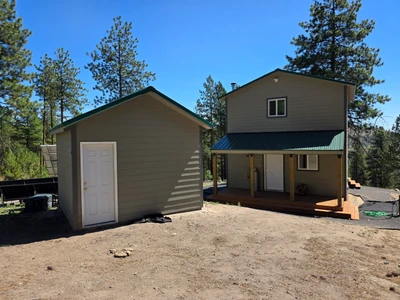

08/25/2025
$270,000
20.38 ac.
ACTIVE
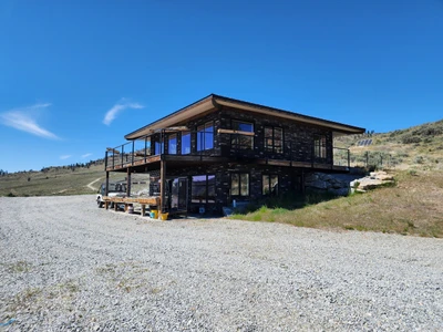
Okanogan County - 147 W High Country, Tonasket, WA
Brand new turnkey off-grid cabin with drilled well, septic, solar system, and water storage. Durable concrete siding, metal roof, and modern comforts including on-demand hot water, gas oven, and full bath. Features a main floor office/bedroom plus large upstairs room. Nicely treed property with good access, just 40 minutes from Tonasket.
Land
This property offers a nicely treed setting with a mix of evergreens and open spaces, creating both privacy and usability. The terrain is gently rolling, providing good drainage and multiple usable areas for recreation or development. Soils are well-suited for gardening and small-scale homesteading projects. The property is easily accessible year-round and provides a peaceful natural backdrop for the cabin.
Improvements
800 sqft new cabin, metal roof, hardy plank siding, concrete foundation,
There are two new sheds as well, one for storage, and the other has a large water tank and a solar water pump approxment
Recreation
This cabin is the perfect basecamp for year-round recreation. The surrounding area offers abundant wildlife for hunting, endless trails for hiking, ATV riding, and horseback adventures, plus nearby lakes and rivers for fishing and boating. Winter brings opportunities for snowshoeing and backcountry exploration, all right from your doorstep.
Agriculture
Suitable for a cow or a few horses, this property offers plenty of room and is mostly fenced, with a few areas set aside for a garden.
Water/Mineral Rights & Natural Resources
Has a well 400 feet, 1.5 gallons per minute
Region & Climate
The Okanogan Highlands are known for their four-season beauty, with warm, sunny summers, crisp autumns, snowy winters, and mild springtime. The area averages plenty of sunshine each year, making it ideal for solar living. Outdoor recreation is abundant, from fishing, hunting, and hiking to snow sports in the winter. The region is celebrated for its quiet landscapes, friendly rural communities, and easy access to thousands of acres of public land.
History
The Okanogan Highlands carry a rich history of ranching, farming, and homesteading, where families carved out a living from the land for generations. This region was once traveled by Native tribes and early settlers drawn by fertile valleys, abundant timber, and wildlife. Today, it remains a place where people come to escape the bustle, embrace self-sufficiency, and enjoy the same natural beauty that's defined the area for over a century.
Location
Located in the scenic Okanogan Highlands, this property is just 40 minutes from the town of Tonasket, where you'll find shopping, dining, medical services, and schools. Larger amenities can be found in Omak, about an hour away, while Wenatchee and Spokane offer regional airports within a few hours' drive. The Canadian border is also nearby, providing easy access to additional travel and recreation opportunities.
03/31/2022
$1,249,000
960 ac.
ACTIVE
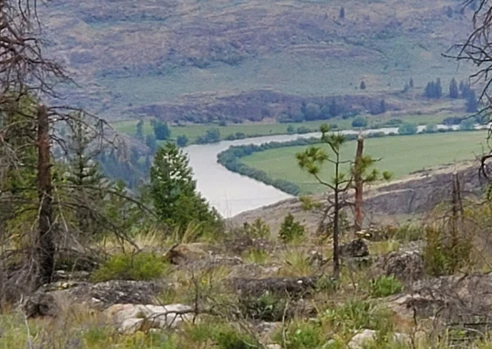
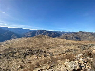
Okanogan County - 960X Knox Rd, Riverside, WA
960 Acres are already subdivided into 20-acre parcels that border state land. Perfect property for hunting, hiking, or trail riding multiple roads throughout the property make it a fun place to explore. Many wildlife, including deer, Elk, and Moose, frequent the property. There are fantastic views across the valley and numerous places to build a home or cabin. And have access to thousands of acres of DNR land. (Owner Financing Now Available)
Land
The 960 acres has already been subdivided into 20 acre parcels
Recreation
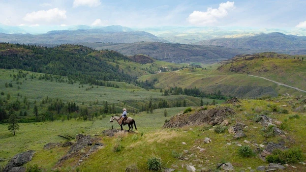
Okanogan County in North-Central Washington State has the best family vacations! Scenic byways, tours, hikes, and family adventures await you in every corner of Okanogan Country: from the Northern Okanogan Region, to the Methow Valley, across the Columbia River Basin, and into the Heart of the Okanogan. An affordable family vacation with endless outdoor adventure awaits you in our breath taking snow-capped North Cascade Mountains and gorgeous winding river basins. Experience a Washington State getaway with horse riding, miniature golf, swimming, fresh wholesome food, blue skies, and starry nights a vacation that will keep you coming back for more!
Region & Climate
Okanogan, Washington gets 13 inches of rain, on average, per year.The US average is 38 inches of rain per year.
Okanogan averages 33 inches of snow per year.The US average is 28 inches of snow per year.
On average, there are 192 sunny days per year in Okanogan.The US average is 205 sunny days.
Okanogan gets some kind of precipitation, on average, 67 days per year. Precipitation is rain, snow, sleet, or hail that falls to the ground. In order for precipitation to be counted you have to get at least .01 inches on the ground to measure.
History
Uriah Ward is given credit for settling Riverside in the 1880s. It was and still is located at the mouth of Johnson Creek, south of Janis Bridge and about 7 miles north of Omak on the Okanogan River. Riverside's name came from its location next to the Okanogan River. Riverside is outside OBHS area but was very important to the north area. When steamboat travel started on the river Riverside became the head of navigation and a mayor distribution center especially during high water.
Riverside was originally known as Republic Landing, was platted by James E. Forde in 1902 and officially incorporated December 22, 1913.
Location
Located within minutes of the town of Riverside with a small store or Omak is just 20 minutes away with all primary services Walmart, Home Deport, or Mid Valley Hospital.
Spokane International airport is 110 miles away
Bellingham International airport is 139 miles away
Seattle International airport is 149 miles away


06/07/2022
$817,000
570 ac.
ACTIVE
Okanogan County - 570X Tunk Creek Road, Riverside, WA
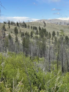
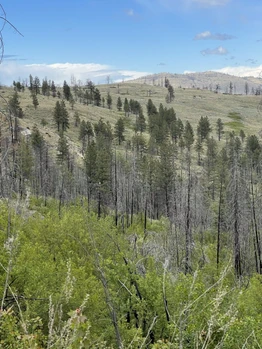
(Owner Financing Now Available) The Figlensky Springs Ranch includes 570 Acres already subdivided into multiple 20 acre parcels. There is varied terrain and timbered land with excellent hunting and majestic views near Riverside, Washington. Borders 1000's of acres of public land for recreational activities.
Land
Embrace Nature's Embrace at Our Serene Ranch Retreat
Nestled within the embrace of nature, our ranch stands as a testament to the beauty and resilience of the land it calls home. As you step onto this picturesque haven, you're welcomed by breathtaking views that stretch over the valley below, inviting you to pause and savor the tranquility that envelopes this special place.
Land That Tells a Story:
In years past, the upper meadow of our ranch was diligently farmed, producing golden hay that nourished the livestock that once roamed these hills. The echoes of hard work and dedication still linger in the air, creating a sense of legacy and connection to the land.
Nature's Lifelines:
Dozens of springs gracefully cascade down from the pinnacle of the ranch, weaving a vital tapestry that ensures the land stays vibrant and lush well into the summer. These natural springs become the lifeblood, a testament to the resilience of the ecosystem that has thrived here for generations.
A Tapestry of Terrain:
The ranch unfolds with diverse terrain, presenting a captivating mosaic of landscapes. From the steeper timbered ground in the higher elevations to the rolling hills that gently cradle a sizable meadow, each contour tells a story of the land's resilience and adaptability. A reflective pond mirrors the sky, adding a touch of serenity to this vibrant tableau.
Northward Whispers of Aspens:
Gazing northward, you'll discover a large thicket of Quaking Aspens, their leaves whispering stories of seasons gone by. These elegant trees, with leaves that flutter like golden coins in the wind, stand as sentinels to the ever-changing beauty of the ranch. Their presence adds a touch of grace to the natural symphony that plays out across the landscape.
Heartfelt Connection to the Land:
Every inch of this ranch exudes a heartfelt connection to the land. It's not just a property; it's a living, breathing testament to the cycles of life, the nurturing touch of water, and the enduring spirit of the wilderness. As you wander through the meadows and stand among the aspens, you can't help but feel a profound sense of belonging to a place where nature and history intertwine.
Discover the Beauty:
Come, explore our ranch, where the views are boundless, the meadows whisper tales of yesteryears, and the aspens stand tall in silent tribute to the beauty that surrounds us. Here, amid the varied terrain and the song of running springs, you'll find not just a ranch but a sanctuary where the heart of nature beats in perfect harmony with our own.
Recreation
Year-round recreation, this ranch lies within the Mule Deer migration route. Enjoy all four seasons activities are endless for the outdoor person. Figlensky Springs Ranch has a variety of topography with some great trails winding thru the property onto thousands of acres of adjoining public lands. Several small lakes can be found in this area, and you might even catch a few fish.
Agriculture
The Figlensky Spring Ranch has been a spring and early summer cattle grazing ranch with lush green grass and a small spring-fed seasonal pond for cattle to drink from. Several springs have been identified on the property. A person could capture more of the fresh spring water available with a bit of work.
There is a fair amount of Mature timber on the ranch. Although a fire did burn many trees in 2015, there seems to be enough timber for the animals to have some decent cover from the weather.
Water/Mineral Rights & Natural Resources
All related Mineral Rights are transferred to the new owner at the time of closing
Region & Climate
Okanogan County, Washington gets 16 inches of rain, on average, per year. The US average is 38 inches of rain per year.
Okanogan County averages 58 inches of snow per year. The US average is 28 inches of snow per year.
On average, there are 189 sunny days per year in Okanogan County. The US average is 205 sunny days.
Okanogan County gets some kind of precipitation, on average, 88 days per year. Precipitation is rain, snow, sleet, or hail that falls to the ground. In order for precipitation to be counted you have to get at least .01 inches on the ground to measure.
Weather Highlights
Summer High: the July high is around 86 degrees
Winter Low: the January low is 20
Rain: averages 16 inches of rain a year
Snow: averages 58 inches of snow a year
History
The western Okanogan Highlands has historically beena significant source of mineral production. While the primary target has been gold, other ore deposits have been mined as well. Midnight uranium mine, The Okanogan Highlands, in the northeast, are an extension of the Rocky Mountains. Their north-south ranges, with summits that rise to more than 7,000 feet (2,100 metres), are separated by glaciated trenches. With a 2020 population of2,594, it is the 153rd largest city in Washington and the 6708th largest city in the United States . Okanogan is currently growing at a rate of 0.08% annually and its population has increased by 1.65% since the most recent census, which recorded a population of 2,552 in 2010. Dry forests of ponderosa pine and low grasses dominate the valleys and mountains in this region. The Okanagan south of Kelowna has a semi-arid climate (Kppen: Bsk) with hot, dry summers and cool winters. The average daytime temperature in this region is about 15.0 C (59.0 F), which is the warmest in Canada.
Location
Omak Airport, also known as Omak Municipal Airport or Omak City Airport, is a regional airport located 3 miles north of Omak, Washington, a city in the Okanogan region of United States.
Address:102J Omak Airport Rd, Omak, WA 98841
Elevation:1,305
Phone:(509) 826-6270
Opened:1956
Serves:Omak
Code:KOMK, OMK

06/13/2025
$100,000
118 ac.
ACTIVE
Okanogan County - Cougar Creek Road, Wauconda, WA
Sale Price: $100,000 or best cash offer
118 Acres of Pristine land in the rural, serene, and quiet area of Wauconda, WA!
This property gives you a flat spot near the road that will give you a location to build your homestead, cabin, or off grid home. This property has mixed terrain which would be great for any recreational activities! There were plenty of sightings of different animal tracks in the area. Tracks of bear and big cats have been seen on the property and surrounding area. Plenty of deer has been seen, along with grouse and other game birds. If hunting is your thing, this could be what you have been looking for! This property borders public lands to the east and northeast boundary of the property. The property holds plenty of young to mature trees. This land is attractive to any recreational activities especially hunting. Imagine building a cabin on this property, having a homebase, and somewhere to get away from the hustle and bustle. The property is South facing, so plenty of sun and natural light throughout the year. This plot of land gives you the elbow room needed for the utmost privacy along with it bordering public lands.
Key Features
- Land Size: 118 acres
- Mixed Terrain
- Diversity of wildlife roaming
- Tracks of many wildlife in the area
- Large property
- Public lands to the northeast corner
- Maintained Dirt Road
Address: N/A Cougar Creek Rd, Wauconda WA 98859
County: Okanogan County, WA
Acres: 118 Acres (Raw land)
Zoning: Vacant land
Coordinates: 48.75274, -118.86666
Water: None
Electric: Alternative
Terrain: Rolling Hills/Mixed Terrain
Septic: None
Easement Road
Cabins: Allowed
No Restrictions
***Please contact me for specific directions***
**PHOTOS WITH BOUNDARY LINES ARE APPROXIMATE AND NOT ACTUAL BOUNDARY**

07/19/2023
$2,100,000
114.7 ac.
ACTIVE
Okanogan County - 2034 Pine Creek Rd, Tonasket, WA
Pine Creek Equestrian Facility Tonasket, WA
Turnkey 114.7-acre irrigated equestrian property featuring two custom barns, 280x150 riding arena, and highly productive alfalfa ground. Barn #1 includes box stalls, heated tack room, wash area, and a 1-bed/1-bath apartment with stall-viewing window. Barn #2 offers ample shop/storage space. Two pivots, wheel lines, two wells, and 12 irrigation mainline. Produces approx. 350 tons of alfalfa annually.
Land
Land Details Pine Creek Equestrian Facility
This exceptional 114.7-acre property is fully irrigated and laid out for maximum agricultural and equestrian utility. The terrain is primarily level, making it ideal for hay production, grazing, and riding. The soil is fertile and well-draining, suitable for high-yield alfalfa cropscurrently producing approximately 350 tons per season. The land is serviced by two working pivots and wheel lines, fed by a 12-inch pressure mainline. Multiple fenced paddocks provide rotational grazing areas for horses or livestock. Mature trees line parts of the property, offering shade and wind protection, while the wide-open fields provide unobstructed views and efficient farm operation. This is a prime example of highly functional and well-maintained agricultural land in the heart of North Central Washington.
Improvements
This is top of the line Equestrian center with everything in almost new condition .
Don't miss one of the largest steel framed free span riding arenas in the area.
Free span riding arena 280x 150
Equestrian barn with 1 bed apartment 17590
Work shop and storage barn 10040
Recreation
Okanogan Valley offers an impressive range of outdoor adventure and recreational activities, including Mountain Biking & Cycling; Boating, Sailing & Cruising; Camping & RVing; Canoeing & Kayaking; Hiking & Backpacking; River Rafting & Whitewater Kayaking; Skiing & Snowboarding; Surfing & Windsurfing; and Snowshoeing & cross-country ski touring. But wait, there's more! If your Okanogan vacation is longer, you can also go Horseback Riding, Houseboating, River Boating, Jet Boating and Rock Climbing, or you can take a trip into the wilderness on an Off road 44 or ATV Tour.
Fishing. here are so many fishable lakes in Okanogan County that even if you managed to try a different one each day of the year, you would have to start young and have a very long life (and maybe a floatplane) to visit them all. Hundreds of pleasant lakes are easily reached and fished with just a vehicle with good ground clearance, a car-top or inflatable boat or float tube, and the right fishing tackle. Explore more than 200 high mountain lakes, 400 lowland lakes, 200 water and wildlife access areas and 300,000 acres of publicly owned land. This is the number one recreational fishing region statewide that includes warm water fisheries and cold water trout and steelhead fisheries. It also boasts the most popular bass fishing sites in the state.
Spectacle Lake is a gorgeous destination, popular for family outing's. It is primarily known for consistently good trout fishing.Expect rainbow of 10 to 12 inches, with good numbers of carryover trout to 15 inches when you try Spectacle.
Hunting. Located in the GMU 215 Sinlahekin. This unit is well known for its great Mule Deer hunting and White tail
District 6 supports perhaps the largest migratory mule deer herd in the state, and Okanogan County has long been prized by hunters for its mule deer hunting opportunity. The district also supports significant numbers of white-tailed deer, particularly in GMUs 204 and 215. The District 6 deer management objective is for stable to modestly increasing populations within the social tolerance limits for nuisance and damage issues. Okanogan County District 6 Hunting Prospects Guide is available here.
Not only deer, black bears have also been seen on this property and Golden Eagles nest among the trees and rocky bluffs year round. Okanogan County boasts high numbers of butterflies and over 200 species of birds and this is due to ideal natural habitats and waterways in your immediate area.
Traverse truly unique terrain sculpted by glaciers and volcanic activity with a wide variety of climate conditions such as dry, warm summer days from Southern winds to colder arctic air flowing South from Canada. If you're a hunter who prefers a variety of experiences all in one place you will find every trip to the field memorable.
Obtaining a license to hunt is a straight forward process in Washington. There is no minimum or maximum age however, hunters born after 1972 will require a hunting education class and children under 8 are required to take an in-person field skills evaluation for a nominal fee. Those with disabilities can obtain licenses and tags at a reduced rate.
Agriculture
A previous Arabian horse equestrian center with multiple-use buildings and irrigation, serving as a breeding facility. The owner went all out when building this facility and is one of Okanogan Valley's premier equestrian barns. No details were overlooked. You would be hard pressed to find another facility this nice and this well built anywhere in the County
Water/Mineral Rights & Natural Resources
Irrigation includes 2 pivots in addition to wheel lines.
General Operations
General Operations Pine Creek Equestrian Facility
Pine Creek is a turnkey, equestrian, and hay operation designed for efficient ranch management. Currently, the property yields approximately 350 tons of high-quality alfalfa annually, irrigated by two center pivots and additional wheel lines connected to a 12-inch pressure line. The irrigation setup allows for minimal labor and consistent crop production throughout the season.
Equestrian operations can be supported by two like-new, custom-built barns. Barn #1 includes modular stalls, a hot water wash bay, a heated tack room, and a comfortable one-bedroom apartment ideal for a ranch hand or manager. barn #2 functions as a large workshop and equipment storage facility. The 280 x 150 free-span riding arena allows for year-round training and events.
This facility offers potential revenue streams from hay sales, boarding, training, riding lessons, or hosting equestrian events. The layout supports both private and commercial use, with minimal overhead and excellent infrastructure. Located just 5 minutes from Tonasket, WA, with easy access to Hwy 97 and a nearby airport, the ranch combines strong agricultural productivity with world-class equestrian features.
Region & Climate
In Tonasket, the summers are hot and dry, the winters are freezing and snowy, and it is partly cloudy year round. Over the course of the year, the temperature typically varies from22Fto90Fand is rarely below8For above98F.
Based on thetourism score, the best time of year to visit Tonasket for warm-weather activities is fromearly Julytolate August.
History
Tonasket is a small community located along the eastern bank of the Okanogan River in north central Okanogan County, Washington. The City was named in honor of Chief Tonasket of the Okanogan Indians who historically used the present city site for an encampment. State Highway 97, the main north-south highway through central Washington, bisects the city on its way north to the Canadian border approximately twenty miles north. The City, with an elevation of approximately 900 feet above sea level, is bordered on the north by Siwash Creek, and the south by Bonaparte Creek. The present population is estimated to be approximately 995.
The City, which has been the site of a U.S. Post Office since 1901, was platted in 1910 and incorporated in 1927.
Tonasket serves as a hub for agricultural and forestry industries in north central Okanogan County.
It is home to the Offices of the Tonasket Ranger District of the Okanogan National Forest. The city is also increasingly becoming a convenient jumping off point for visitors coming to the area to enjoy the myriad of opportunities for outdoor recreation in the surrounding areas.
Many descendants of pioneer families still reside in Tonasket and the surrounding areas and are interested in preserving and sharing the history of their heritage.
Location
Tonasket, WA Airports nearby
Penticton Regional Airport (52.9 miles / 85.2 kilometers)
Kelowna International Airport (86.6 miles / 139.3 kilometers)
West Kootenay Regional Airport (91.7 miles / 147.5 kilometers)
Spokane International Airport (115.6 miles / 186.0 kilometers)5 Minutes to Tonasket, WA
30 minutes to Walmart Supercenter
30 minutes to Omak City
32 minutes to Wenatchee Valley College North
36 minutes to Sinlaheken Wildlife Area
37 minutes to Okanogan Valley Golf Club
38 minutes to Conconully Lake
38 minutes to Lake Osoyoos and Canadian Border
40 minutes to Bannon Mountain Trailhead
44 minutes to Omak Lake
48 minutes to Fourth of July Trailhead
1 hour to Loup Ski Bowl
1 hour 43 minutes to North Cascades Heli Skiing
3 hours 10 minutes to Spokane, WA & GEG International Airport

12/19/2024
$225,000
0.29 ac.
ACTIVE
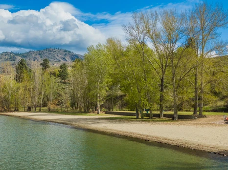
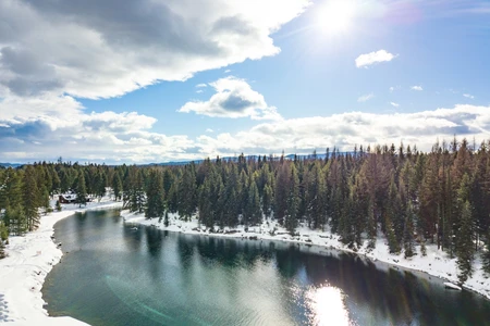
Okanogan County - 685 Loomis Oroville Rd, Tonasket, WA
Hard to find lakefront lot on Spectacle Lake which is an 80 acre lake stocked with Rainbow trout and Kokanee plus other species. There is a WDFW boat launchs as well as 2 private resorts on the lake with boat launches. This lot is ready for 2 RV's, tiny homes or build your lakefront retreat. The property features 2 full RV hookups and a newly installed quality aluminum dock with ramp giving you great access to the lake.
Improvements
New aluminum dock and access ramp
2 RV hookups
Drilled well
Electricity
Recreation
Spectacle Lake is a gorgeous destination, popular for family outtings. It is primarily known for consistently good trout fishing.Expect rainbow of 10 to 12 inches, with good numbers of carryover trout to 15 inches when you try Spectacle.It is a long narrow lake, and in the shallows you can treat yourself to fast-action fishing for largemouth bass, that are typically small but really fun to catch.There are good numbers of big bluegill (6 to 8 inches) and small yellow perch in Spectacle as well.The occasional brown trout is also caught on the lake.There are two WDFW launch sites on the lake and three resorts that offer full services.Spectacle Lake is located seven miles northwest of Tonasket on the Loomis-Oroville Road.
05/23/2024
$1,495,000
708.98 ac.
ACTIVE
Okanogan County - 709 Old Hwy 97, Brewster, WA
Brewster 709 consists of 37 parcels total with 2 parcels totaling 103.5 acres zoned R1 and fronting on Old Hwy 97 allowing for future development. With development you get access to the Silver Spur amenities which includes access to the lodge, pool, spa, gym, tennis courts, playground and riverfront beach access. There are 3 drilled wells and currently 6 RV sites with plenty of room for expansion.
Land
Seize the opportunity to own 708.98 acres of prime land at Silver Spur North, consisting of 35 parcels with incredible development potential. This expansive property includes two parcels totaling 103.5 acres zoned R1 Rural 1, fronting Old Hwy 97, perfect for future development projects.
Property Highlights:
Development Potential: With R1 Rural 1 zoning, these 103.5 acres are primed for residential development, providing a fantastic investment opportunity.
Silver Spur Amenities: Gain access to exclusive Silver Spur amenities, including a lodge, pool, spa, gym, tennis courts, playground, and riverfront beach access.
Infrastructure in Place: The property features 3 drilled wells and 6 RV sites, offering ample room for expansion. Additionally, an onsite gravel pit facilitates road building.
Year-Round Recreation: Enjoy 300 days of sunshine annually, with proximity to Lone Point Cellars, Loup Loup Ski Bowl, Gamble Sands Golf Course, and numerous lakes and rivers for fishing.
Stunning Views: The higher elevations of the property provide breathtaking views, a must-see for anyone looking to develop in a picturesque setting.
Don't miss this rare chance to invest in a versatile and scenic property with endless possibilities for development and recreation. Explore the potential of Silver Spur North today!
Improvements
Large Metal Shop 40100 with concrete floor and power doors open at both ends
Recreation
Developer Alert! Prime 708.98 Acres at Silver Spur North
Seize the opportunity to own 708.98 acres of prime land at Silver Spur North, consisting of 35 parcels with incredible development potential. This expansive property includes two parcels totaling 103.5 acres zoned R1 Rural 1, fronting Old Hwy 97, perfect for future development projects.
Property Highlights:
Development Potential: With R1 Rural 1 zoning, these 103.5 acres are primed for residential development, providing a fantastic investment opportunity.
Silver Spur Amenities: Gain access to exclusive Silver Spur amenities, including a lodge, pool, spa, gym, tennis courts, playground, and riverfront beach access.
Infrastructure in Place: The property features 3 drilled wells and 6 RV sites, offering ample room for expansion. Additionally, an onsite gravel pit facilitates road building.
Year-Round Recreation: Enjoy 300 days of sunshine annually, with proximity to Lone Point Cellars, Loup Loup Ski Bowl, Gamble Sands Golf Course, and numerous lakes and rivers for fishing.
Stunning Views: The higher elevations of the property provide breathtaking views, a must-see for anyone looking to develop in a picturesque setting.
Don't miss this rare chance to invest in a versatile and scenic property with endless possibilities for development and recreation. Explore the potential of Silver Spur North today!
Agriculture
There is approximately 100 + acres of pasture / hay ground
General Operations
There is potential for instant income from renting the six RV spots that have water and power to each of them. There is an opportunity grow some hay or lease out the 100 plus acre hay field that produces some great hay. The hay field was farmed for may years and just needs a little work to get it back in production and producing income.
Region & Climate
Brewster, WA, experiences a pretty distinct climate with hot, dry summers and cold, snowy winters. Here's a bit more detail:
**Summers:** Expect clear skies with temperatures usually ranging between 70F to 90F. It's rare for the mercury to hit 99F, but it can happen during a heatwave.
**Winters:** It gets quite cold, with temperatures often dropping to around 23F. The coldest days can see temperatures plummet to about 10F. Snowfall is common, and the skies are often partly cloudy.
**Year-Round Temperature Range:** The annual temperature swing is from about 23F to 90F, providing a significant contrast between the seasons.
This variation offers a nice mix for those who enjoy both warm, sunny weather and the crispness of a snowy winter. If you're into outdoor activities like hunting and fishing, Brewster's climate gives you a full range of seasonal experiences.
History
Brewster has an interesting history and a steady, agriculture-based economy:
**Location:** Situated in Okanogan County, Brewster lies at the confluence of the Columbia and Okanogan Rivers, which provides both scenic views and practical benefits for agriculture.
**Origins:** The town was originally called Bruster, named after its founder John W. Bruster, who platted it in 1896. The name was changed to Brewster when the post office opened in 1898.
**Incorporation:** Brewster officially became an incorporated town on April 29, 1910.
**Railway:** The completion of the Great Northern Railway's Oroville-Wenatchee Branch Line in 1914 was a significant development, likely boosting local commerce and connectivity.
**Economy:** The local economy thrives on agriculture, particularly fruit orchards. This has supported gradual population growth, reaching nearly 2,500 residents.
The combination of historical charm, agricultural prosperity, and natural beauty makes Brewster a unique and appealing small town in Washington State.
Location
Brewster, Washington, is beautifully situated at the meeting point of the Columbia, Okanogan, and Methow Rivers, providing it with a unique and picturesque setting. Here are some highlights:
**Geography:** The town benefits from its location at the confluence of three rivers, which not only offers stunning views but also fertile land for agriculture.
**Scenic Backdrop:** To the west, the snow-capped peaks of the Cascade Range create a breathtaking backdrop, with their foothills rolling down to meet the riverbanks.
**Agriculture:** The dramatic topography, with steep hills descending towards the rivers, creates an ideal microclimate for growing apples and cherries. Orchards thrive in this environment, surrounding the town and contributing to its economy.
**Natural Beauty:** The combination of river confluence, mountainous terrain, and lush orchards makes Brewster a visually striking location with a rich agricultural heritage.
This blend of natural beauty and agricultural productivity makes Brewster a special place, perfect for those who appreciate both the outdoors and a strong community tied to the land.

05/19/2025
$1,700,000
558.3 ac.
ACTIVE
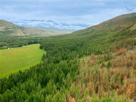
Okanogan County - Morning Sun Road, Tonasket, WA
This remarkable 558+ acre ranch offers panoramic views overlooking the valley below and the snow-capped Cascade Mountains to the west. The land is a mix of sandy loam soils with rocky outcroppings, natural grasslands, and sagebrush. Scattered groves of quaking aspens and pine trees provide ideal cover and habitat for wildlife, making this property a prime location for both cattle grazing and hunting.
Land
This remarkable 558+ acre ranch offers panoramic views overlooking the valley below and the snow-capped Cascade Mountains to the west. The land is a mix of sandy loam soils with rocky outcroppings, natural grasslands, and sagebrush. Scattered groves of quaking aspens and pine trees provide ideal cover and habitat for wildlife, making this property a prime location for both cattle grazing and hunting.
The ranch supports abundant white-tailed and mule deer, offering excellent recreational opportunities. With a south-facing orientation, the property enjoys full sun throughout the dayperfect for agriculture, livestock, or solar use.
A well-developed road system includes solid all-weather gravel roads and numerous spur trails that reach different areas of the ranch. Whether you prefer to explore by ATV, horseback, or on foot, the terrain is accessible and enjoyable year-round.
This is a rare opportunity to own a large, scenic, and usable piece of the Okanogan Highlandsperfect for ranching, recreation, or a private retreat.
Improvements
Expansive Multi-Home Ranch on 558+ Acres Okanogan Highlands
Discover unmatched privacy and self-sufficiency on this rare 558+ acre property in the stunning Okanogan Highlands. Spanning six separate parcels, this ranch is ideal for a multigenerational homestead, off-grid retreat, or long-term investment.
The main custom home features over 1,700 square feet with open-beam ceilings, a cozy pellet stove, and a large kitchen with granite countertops. A spacious loft offers an additional sleeping area and a bathroom with rustic charm.
The second home mirrors the main house in quality and design, tucked into the hillside for natural insulation and year-round comfort.
Above the two-bay pole barn is a studio-style living unit with its own bathroomperfect for guests, rental income, or a caretaker. Additional amenities include an insulated workshop and several outbuildings for storage or hobby use.
Designed for off-grid living, the property is powered by two solar systems with a backup generator for reliability. Water is abundant with three wellsincluding a primary 80-foot well producing 20 gallons per minuteand several natural springs.
A working gravel pit provides building materials on-site, including granite rock and usable gravel.
This one-of-a-kind property offers peace, privacy, and the freedom to live your dream lifestyle in one of Washington State's most beautiful regions.
Recreation
Recreation Possibilities for Lookout Ranch & Okanogan County
Lookout Ranch offers unmatched recreational opportunities right out your front door. With over 558 acres of diverse terrainrolling hills, timbered slopes, grassy meadows, and rock outcroppingsthe land is a haven for outdoor enthusiasts. The property is ideal for horseback riding, hiking, ATV exploration, and wildlife viewing. South-facing slopes and all-weather gravel roads make year-round access easy, whether you're on foot, horseback, or using a side-by-side.
The ranch is a hunter's paradise, with abundant populations of mule deer, white-tailed deer, black bear, cougar, coyotes, and upland birds. The natural cover of pine trees and quaking aspens combined with open sage and grassland creates ideal habitat and hunting conditions.
Nearby Recreation in Okanogan County:
Okanogan County, the largest county in Washington State, is known for its vast public lands, stunning natural beauty, and four-season recreation. Within a short drive from Lookout Ranch, you'll find:
Lakes & Rivers: Fish or boat on nearby lakes such as Spectacle Lake, Wannacut Lake, Palmer Lake, and Lake Osoyoos. The Similkameen and Okanogan Rivers also offer excellent fishing and floating opportunities.
Hiking & Backpacking: Explore trails in the Okanogan National Forest or head to the Pasayten Wilderness for remote alpine adventures.
Skiing & Snow Activities: Loup Loup Ski Bowl offers downhill skiing, snowboarding, and Nordic trails. Snowmobiling is also popular in the surrounding highlands.
Golf & Wine: Enjoy a round at Gamble Sands, one of the top-rated golf courses in the country, or visit nearby wineries and tasting rooms.
Wildlife & Birdwatching: The region is a hotspot for birders and nature photographers, with diverse habitats supporting hundreds of species.
Whether you're looking for peaceful solitude, adventurous outings, or a bit of both, Lookout Ranch and Okanogan County provide an incredible setting for recreation year-round.
Agriculture
Agricultural & Land Use Potential for Lookout Ranch
Lookout Ranch, with its expansive 558+ acres in the heart of Okanogan County, offers a wide array of agricultural and land use opportunities. The combination of topography, soils, water access, and infrastructure makes this a highly versatile property suitable for farming, livestock, timber management, and even vineyard potential.
Water/Mineral Rights & Natural Resources
Mineral rights are transferred to buyers at closing
General Operations
Cattle & Livestock Grazing
The ranch's gently rolling hills, native grasses, and mix of sagebrush and timber provide excellent grazing grounds for cattle, horses, or other livestock. The property is already partially fenced and includes stables built into the main residence as well as ample room for additional pasture management or rotational grazing systems. The presence of a natural spring and a productive well ensures year-round water access for animals.
Key Features:
Sandy loam soils with natural grass cover
Artesian springs and wells for livestock water
Stables and outbuildings in place
Room to build corrals, barns, and a riding arena (partially complete)
Onsite Resources & Infrastructure
Gravel Quarry: A private gravel pit provides materials for road maintenance and future building.
Workshops & Garages: Ideal for equipment storage and repairs
Multiple Outbuildings: Flexible for feed storage, equipment, or conversion to ag-use
Solar Power: Reduces operating costs and supports off-grid independence
Region & Climate
Located in scenic Okanogan County, Washington, Lookout Ranch enjoys a semi-arid climate with over 300 days of sunshine each yearideal for outdoor living and agriculture. Summers are warm and dry with average highs in the 80sF, while winters are cold and snowy, offering a classic four-season experience. Annual precipitation averages around 1012 inches, with about 28 inches of snowfall. The area is known for its rich outdoor recreation, including fishing in nearby lakes, hunting, hiking, horseback riding, and wildlife viewing. The surrounding region boasts small-town charm, with Tonasket, Oroville, and Republic offering essential amenities, festivals, farmers markets, and a strong agricultural heritage.
History
The Lookout Ranch sits in the heart of the Okanogan Highlandsa region steeped in rich history and cultural significance. For centuries, the area was home to Native American tribes, particularly the Okanogan people, who used the valleys and highlands for seasonal hunting, fishing, and gathering. Aeneas Valley, just to the east, was historically a wintering ground due to its milder climate and abundant resources.
By the late 1800s and early 1900s, settlers and homesteaders arrived, drawn by the region's fertile grazing lands and timber resources. Many of these original homesteads, some still marked by old cabins and outbuildings, were established for cattle ranching and small-scale farmingtraditions that continue today. The property itself was once part of a larger cattle operation and has retained its ranching roots with infrastructure designed for livestock and off-grid living.
Over the years, the land has remained largely undeveloped, preserving its natural beauty and historic character, with panoramic views that have likely remained unchanged for generations. The combination of open rangeland, wooded groves, and natural springs gives a glimpse into the area's working heritage and unspoiled wilderness.
Location
The Lookout Ranch is located in the scenic Okanogan Highlands of North Central Washington, offering both seclusion and accessibility. Nestled between the small towns of Tonasket (approximately 2530 minutes away) and Republic (around 40 minutes away), the property sits in a quiet, elevated position with sweeping views of the surrounding valleys and Cascade Mountains.
For regional travel, the nearest small airport is the Tonasket Municipal Airport, which features a 3,000-foot paved runway suitable for private planes. The closest major airport is Spokane International Airport, about 2.5 to 3 hours away, offering full commercial service. Wenatchee's Pangborn Memorial Airport is another option, located roughly 2.5 hours to the south.
Basic amenities, including grocery stores, gas stations, restaurants, schools, and medical facilities, can be found in Tonasket and Republic. For more extensive shopping and services, Omak and Oroville are within a 45-minute drive, featuring big-box stores like Walmart and hardware outlets such as Home Depot.
Despite its remote feel, Lookout Ranch is ideally positioned for those seeking a balance between privacy and practicality, with reliable year-round road access and all the essentials within a reasonable drive

04/25/2024
$460,000
0.64 ac.
ACTIVE
Okanogan County - 41 Champerty Rd, Oroville, WA
Incredible opportunity to own a build able lot with 234 feet of sandy beach on Lake Osoyoos with all utility/service hookups on site offering relaxation and recreational enjoyment. This property is at the end of the road with a private setting in the Champerty Shores Neighborhood. Sweeping western views of Lake Osoyoos, Canada to the north and phenomenal sunsets. Boat launch on site. Utility and storage shed with power. Community pond for enjoyment down the street. Short drive to downtown and the Canadian border. Bring your RV and boat while you plan your next build.


04/19/2024
$445,000
0.64 ac.
ACTIVE
Okanogan County - 41 Champerty Rd, Oroville, WA
This is probably the Best buildable lot on the lake. Only one neighbor! And 234 feet of the finest sandy beach on Lake Osoyoos with all utility/service hookups on site offering relaxation and recreational enjoyment. This property is at the end of the road with a private setting in the luxurious Champerty Shores Neighborhood. Sweeping western views of Lake Osoyoos, Canada to the north and phenomenal sunsets. Boat launch on site. Utility and storage shed with power. Community pond for enjoyment down the street. Short drive to downtown and the Canadian border. Bring your RV and boat while you plan your next build. So much to see and do!

07/03/2025
$1,750,000
5.07 ac.
ACTIVE
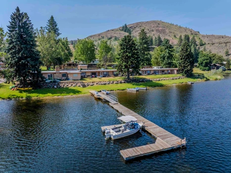
Okanogan County - 10 McCammon Rd, Tonasket, WA
Rare opportunity to own and operate a resort with over 500 feet of manicured lakefront. This established property includes 16 motel units and 36 RV/campsites with full hookups, all just steps from the water. A 3-bedroom, 2-bath home with an attached office and general store serves as both the living quarters and the hub for guest services. Amenities include irrigated grounds, a heated pool, playground, BBQ areas, docks, boat rentals, and a shower house. Located on Spectacle Lake and surrounded by other lakes, hiking trails, and hunting areas, the resort offers year-round access to outdoor recreation. Known for excellent fishing and water sports, this location draws visitors from all directions.

07/06/2023
$1,380,000
536.39 ac.
ACTIVE
Okanogan County - 734 Tunk Creek, Riverside, WA
Central Washington Ranch on Tunk Creek consists of 576 acres of native bunch grasses, sagebrush and some timber (536 deeded acres and 40 acres DNR) with over of mile of Tunk Creek running through the entire property East to West. Tunk Creek is a year round with Rainbow trout. Above the creek, is a custom built 1700 sqft ranch home built in 2004, 2 bed 2.5 bath w/loft. 36x36 pole barn features tack room, two horse stalls, 12x24 finished shop area, horse pens and a separate set of cattle working corrals w/chute. Year around mountain Spring with spring box feeding mountain tank. Over 1140 acres of pasture inside the fences. Property borders over 1600 acres of the Tunk Creek Wildlife area and 9000 acres of WA State land. Great hunting ground. Wildlife abounds, Mule & Whitetail deer, turkeys, elk, black bear and mountain lions. Fence and cross-fences set up for rotational grazing. Paved maintained roads for year round access on school bus route. Just a few miles outside of the town of Riverside, setting above the Okanogan River.
Copyright 2023 Spokane Association of REALTORS. All rights reserved. All information provided by the listing agent/broker is deemed reliable but is not guaranteed and should be independently verified.

04/05/2022
$2,225,000
430 ac.
ACTIVE
Okanogan County - 240 Mc Farland Creek Road, Methow, WA
This exceptional Mountain Ranch offers 430+ ac. of stunning rural living. Secluded & private, access by county road or plane w/2,600 ft airstrip that can be extended to 4000 feet. 80 ac. of irrigated farmland, rich soil, & hundreds of ac. of wooded mountainside/trails. 1 bed, 1 bath home w/garden, deck,& patio. 29 X 40 shop, w/ 3 phase pwr & ample workspace. Limitless recreational fun just outside your door! Conservation Easement in place with excluded areas. Space for 2 addit. homes, RV hook-ups, 3 ponds, McFarland Creek Frontage. Adjudicated water rights for irrigation and domestic well water usage. This could be your slice of paradise!

05/31/2023
$275,000
100.28 ac.
ACTIVE
Okanogan County - 3 XX Buckhorn Mountain Road, Pateros, WA
100+ Acres on 3 contiguous tax parcels overlooking the Methow River and surrounding mountains off Buckhorn Mountain Road! Ideal location for your next home, cabin, or recreational use. Sweeping views in all directions with incredible sunsets and sunrises cascading vibrant color over the valleys and hillsides throughout the year. Abundant wildlife crossing frequently including large game animals such as deer and elk. Buyer to install a well and septic system. Power availability nearby. Buckhorn Mountain Road connects to Burma Road and Bill Shaw Road.


07/07/2023
$3,500,000
862 ac.
ACTIVE
Okanogan County - 3 Summer Road, Tonasket, WA
Wauconda Ranch with over 860 acres and NO Conservation Easements in beautiful Okanogan County between Tonasket and Republic Washington. Ideal grazing land. Main home is 4 bedrooms/2 Bathrooms with 3000 sq. ft., Second Home 5 Bedrooms/2.5 Bathrooms with 5120 sq.ft., Hunting cabin, 2 cattle facilities, multiple barns, sheds, & shop. Sawmill nestled in the timber for sawing your own beams. Beautiful alfalfa & grass fields, meadows, multiple adjudicated water sources as well as 2 creeks, a pond, & responsibly managed timber that is connected to thousands of acres of USFS Land. Wauconda Ranch also holds the USFS grazing Permit for the Mt. Annie Allotment that is over 3000 acres- available after this grazing season.


06/22/2021
$1,695,000
435 ac.
ACTIVE
Okanogan County - 81 East Dry Coulee Road, Okanogan, WA
Incredible opportunity to own 435 acres with a 3800 ft. private runway (Airport Identifier WT37) and 48'x60' hanger/shop with utilities. Potential opportunity to build on 30+ lots throughout the offered parcels. Washington State Fish and Wildlife Game Farm and Shooting Preserve. Pheasant, Chukar, and 3 kinds of Quail being raised and introduced on site into the property. Private hunting property that provides tourism option for visitors from all over the country. 220 acres of ideal hunting land w/ cover in lower fields + 176 more up above. Fly in and hunt w/ anyone you want. Virtual tour shows surrounding areas that provide recreational options for the area. These kinds of property do not come on often. Make sure to see it before its gone!

06/20/2025
$27,500
5 ac.
ACTIVE
Okanogan County - Tonasket, WA
Level parcel in the desirable Aeneas Valley Sun Ranch Association. This parcel offers great views of the surrounding mountains. Nature lovers will enjoy the abundant wildlife that graces this land. With level ground, your dreams of building the perfect getaway become a reality. Nearby lots of public lands and several recreational fishing lakes. Sun Ranch offers a community well and shower house about 5 minutes away and has road maintenance and snow removal on the roads within the HOA. Priced to sell.

11/17/2022
$595,000
35.72 ac.
ACTIVE
Okanogan County - Wolf Creek Rd, Mazama, WA
Midway between Mazama and Winthrop is an amazing territorial view property of the valley. Numerous choice building sites that overlook fields and the North Cascade mountains. In the winter, step out your door and hit the ski trail. The rest of the year enjoy privacy, wildlife, mountain bike trails and hiking in your back yard. This property is wooded with Aspen groves and backs up to USFS lands. Access easement newly recorded through eastern parcel.


06/06/2025
$2,650,000
142.65 ac.
ACTIVE
Okanogan County - 251 Burma Road, Methow, WA
Incredible opportunity to own one of the best properties on the Methow River. 142+ acres with nearly a mile of river frontage. Property currently includes two homes, mature orchards, and areas to build future homes. Main home is 2 bed, 2 bath log home w/ 1492 sq.ft. + loft and basement. Second home is 3 bed 2 bath w/1152 sq. ft. Manufactured Home for additional living space or rental. These 5 contiguous parcels reside in the highly desired Methow Valley midway between Pateros and Twisp with additional across the road. Enjoy the surrounding vistas and river access for recreational pleasure and some of the best cutthroat and rainbow trout fishing in the Northwest. Orchard is approximately 48 acres with mature apple and pear trees.


05/22/2023
$55,000
40.49 ac.
ACTIVE
Okanogan County - 5 Mile Road, Tonasket, WA
Bring your ideas to this 40+/- acre property in Okanagon County, just outside of Tonasket. Great opportunity for recreational activities such as camping, hunting and riding ATV's.


03/29/2024
$795,000
35.72 ac.
ACTIVE
Okanogan County - Wolf Creek Road, Mazama, WA
Midway between Mazama and Winthrop is an amazing territorial view property of the valley. Numerous choice building sites that overlook fields and the North Cascade mountains. In the winter, step out your door and hit the ski trail. The rest of the year enjoy privacy, wildlife, mountain bike trails and hiking in your back yard. This property is wooded with Aspen groves and backs up to USFS lands. Access easement newly recorded through eastern parcel.


1
2

